Every bug-out plan that involves movement assumes roads. Drive to the rally point. Walk the shoulder if the truck won't start. Follow the county road to the retreat property. It's the default mental model — and it's also the first assumption that breaks down the moment a situation is serious enough to force you to move in the first place.
Roads concentrate people. On a normal day that's a minor inconvenience — slower commutes, a few extra minutes at a light. In a wide-area emergency, it's the central problem. Every other evacuee, every checkpoint, every stalled vehicle, every person watching for stranded travelers is on the same corridor you're trying to use. The route that gets you across town in twenty minutes on a normal Tuesday becomes the worst place to be the moment normal breaks.
Why the Road Stops Being Your Friend
Three things turn roads from an asset into a liability once an emergency is serious enough to disrupt normal traffic patterns.
- Chokepoints. Bridges, tunnels, overpasses, and narrow passes are single points of failure. One stalled vehicle, one collapsed structure, one roadblock — official or improvised — stops everyone behind it. The road that funnels traffic through a chokepoint on a good day funnels an entire evacuating population through that same single spot on a bad one.
- Predictability. Frightened people default to roads, which means anyone with a reason to intercept evacuees — checkpoints, opportunists, or simply an overwhelmed authority trying to control movement — checks roads first. The space between roads is, by comparison, almost entirely unwatched.
- Exposure. Roads sit in open cuts with clear sightlines in both directions and little to no concealment. You can be seen from a long way off. So can anyone approaching you.
Move Near the Road, Not On It
The practical alternative isn't to abandon the road network entirely — it's to stop walking on top of it. Travel parallel to a road corridor, offset into the treeline, field edge, or hedgerow running alongside it, close enough to use the road as a navigation reference but far enough to stay out of the sightlines of anyone using it. You get the road's orientation value without its exposure.
This is terrain association in practice: navigating by recognizing and following physical features — a ridgeline, a drainage, a treeline, a fence line — rather than fixating on a compass bearing and walking it blind. Bearings drift with every obstacle you route around. Terrain features don't move, and a route that follows them is both easier to hold and easier to backtrack if you need to.
Cut Lines: An Underused Movement Corridor
Utility right-of-ways — the cleared strips cut through forest and farmland for power transmission lines, pipelines, and some telecom corridors — are one of the most overlooked assets for cross-country movement. They're maintained clear of major vegetation, they run for miles largely independent of the road network, and unlike roads, almost nobody thinks to look for people using them.
The clear sightline that makes a cut line good for movement also makes it good for orientation — you can confirm your direction of travel against a known landmark far more easily on an open corridor than from inside a treeline. The tradeoff is the same openness that helps you: a cut line offers little concealment, and you're visible from a distance both on the ground and from the air. Use them to make distance and check your bearing, not to linger.
Railways: A Reliable Line, Used Carefully
Trains can't climb steep grades, which means rail lines are engineered to take the flattest, most consistent path available through the terrain — often a more direct route than the road network, especially in hilly or mountainous country. A rail line also doesn't change direction unpredictably the way a road does to avoid private property or follow a county boundary. Once you've confirmed your heading along one, you can hold it for miles without re-checking.
That makes a railway an excellent navigation handrail. It does not make the rail bed itself a safe place to walk.
Movement Discipline: Staying Unpredictable
Route selection only does half the job. How you move along that route matters just as much, particularly if there's any chance someone is actively looking for people on the move.
- Vary your route and timing — never repeat the exact same path or schedule if you're making more than one movement
- Move during lower-activity windows like early morning or dusk, but avoid full darkness unless your navigation and footing are solid — twisted ankles and lost bearings cost more than the concealment is worth
- Avoid silhouetting yourself on ridgelines or open skylines; stay below the crest and cross at the lowest, most covered point available
- Rest and halt in concealment, off any travel corridor — not in the open, and not on the same line you've been moving along
- Stop periodically to look and listen before continuing, rather than moving continuously and missing what's around you
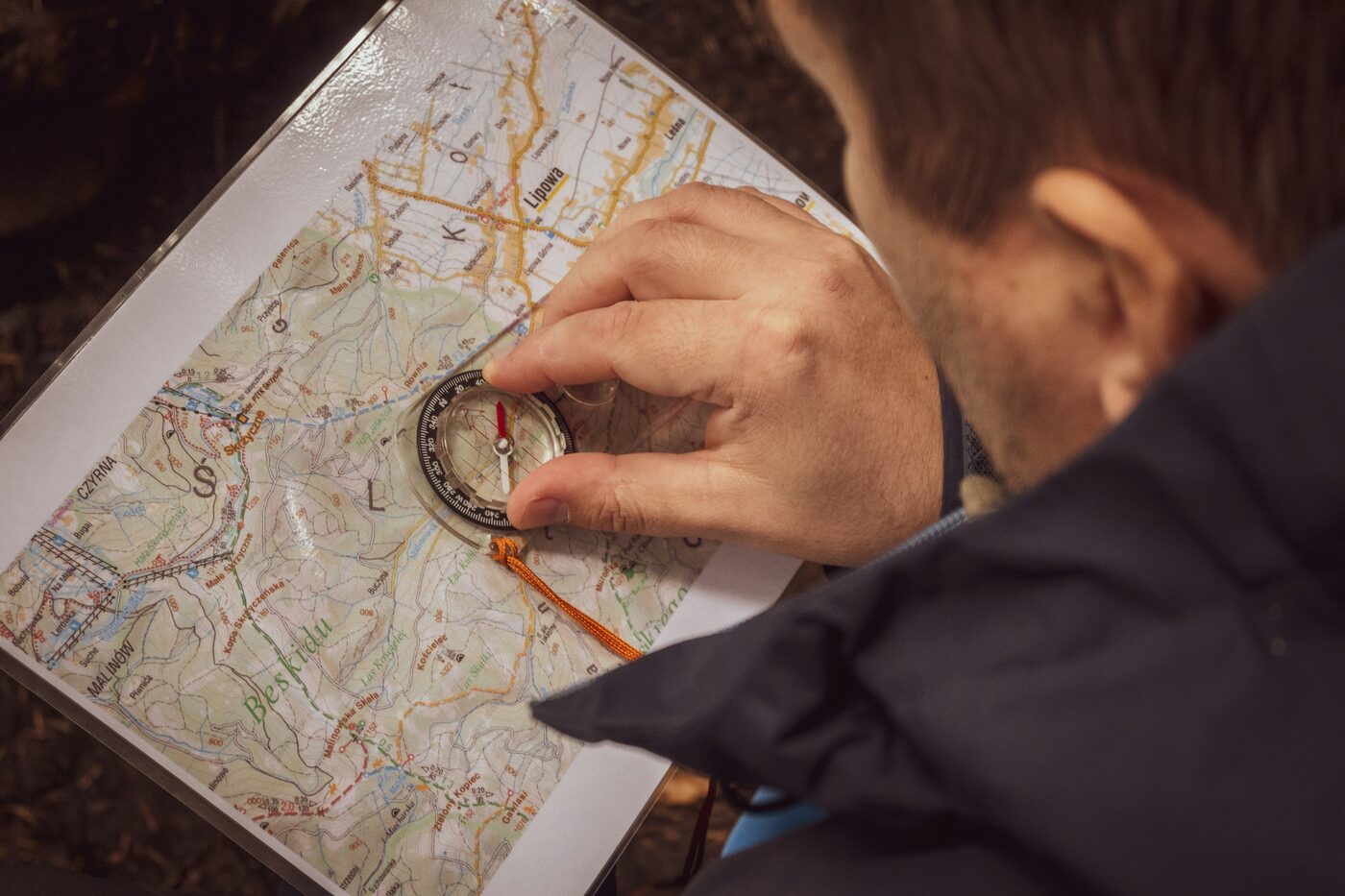
Finding North Without a Compass
If you've lost your compass, or never had one, you still have three reliable ways to find a working bearing. The shadow-stick method works anywhere in daylight: plant a straight stick vertically in open ground, mark the tip of its shadow, wait fifteen to twenty minutes, and mark the new shadow tip. A line drawn between the two marks runs roughly east–west, with the first mark to the west and the second to the east — a line perpendicular to it gives you north–south. If you're wearing an analog watch, point the hour hand at the sun; the line bisecting the angle between the hour hand and the 12 o'clock mark points south in the Northern Hemisphere (north in the Southern Hemisphere) — just account for daylight saving time if it's in effect. After dark, the North Star is the most reliable fixed reference available: find the Big Dipper, follow the line formed by the two stars at the outer edge of its bowl roughly five times their separation, and you'll land on Polaris, which sits within about a degree of true north and barely shifts position through the night. Skip the moss-on-trees method — moss grows wherever it's damp and shaded, which has far more to do with local conditions than compass direction, and it will mislead you as often as it helps.
Movement after the grid goes down isn't about speed. It's about staying unseen, staying oriented, and not burning your energy or your luck on the one route everyone else is funneling toward. Corridor awareness, movement discipline, and a basic, device-free way to hold a bearing form a redundant system that doesn't depend on a working GPS, a charged phone, or a road that's still passable when you need it.
